Brazil
Fordlandia, Brazil
by Angie Cope
I’ve worked at the AGS Library for over a decade and I am still amazed to find materials on nearly every topic. A couple years ago I caught the last 15 minutes of the PBS television special on Henry Ford (available online). Among Ford’s successes and failures was mention of his Utopian community built in the Amazon rainforest. Returning to work, I checked the map drawers to see if I could find any maps of Fordlandia.
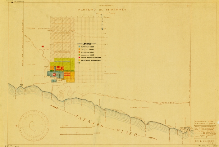
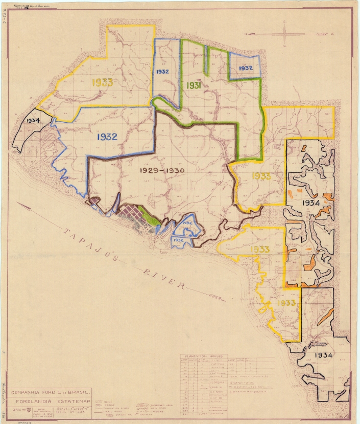
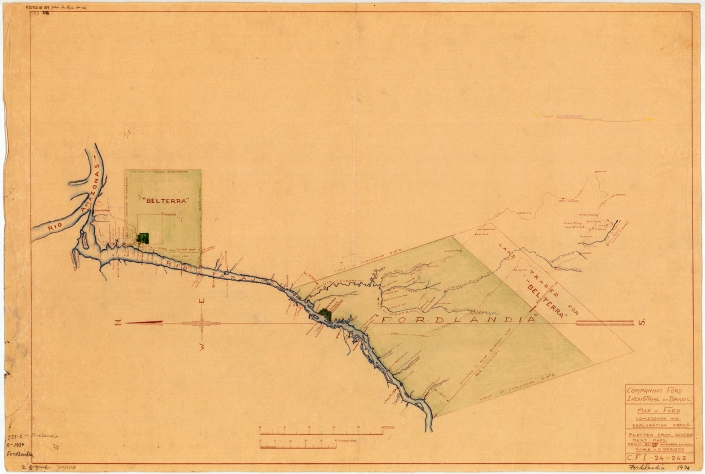
Sure enough, I discovered three annotated, blueline print maps dontated to the AGS in 1939 from Dr. Lewis Hanke. Hanke was a preeminent Latin American historian who corresponded with the AGS while researching his Handbook of Latin American studies.
The Fordlandia story generally goes like this …
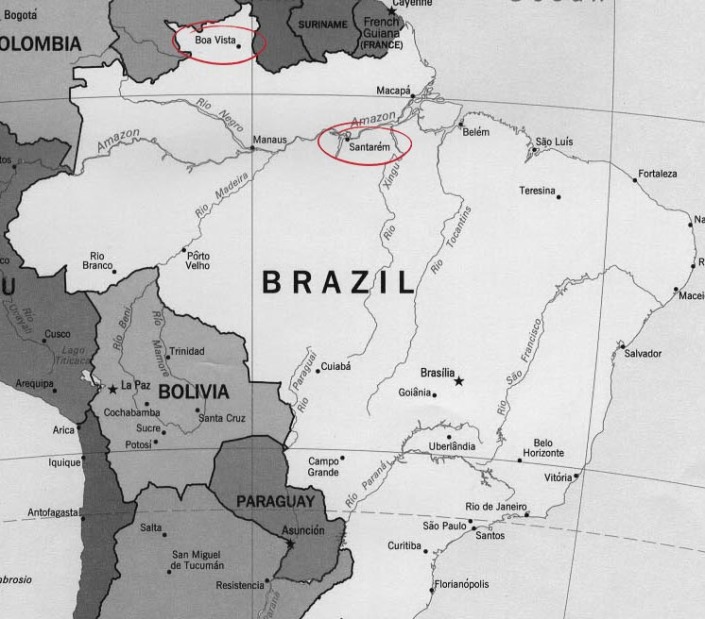
In 1927 Henry Ford purchased 2,471,000 acres of land in the Amazon rainforest from the State of Para, Brazil. Ford ambitiously hoped to free his company’s dependence on foreign rubber by starting a rubber plantation. This first concession of land was in the north of Brazil at Boa Vista.
Clearing of the land began in 1929 and production problems ensued almost immediately. Ford had relocated employees from the U.S. to run the plantation and hired local workers as labor. Personnel issues ranged from illness and homesickness to rebellion. The city was modeled after Dearborn, Michigan and had a power plant, library, golf course, barber, hospital, and housing for employees. Ford expected residents would enjoy leading a wholesome American lifestyle, eating hamburgers and living in homes similar to those in Dearborn. Quickly, local workers protested working conditions. Among their grievances was working 8 hours during the heat of the day when they were accustomed to working early-morning and late-evening shifts. Conditions became so bad that workers rioted.

________________________________________________
In addition to personnel issues, Ford’s engineers lacked knowledge of growing rubber trees. Seeds were planted too closely together making them easy prey for tree disease and pests. Before long, most of the trees died.
By 1934, the State of Para exchanged 695,586 of the original acres for an equal-sized waterfront area 30 miles south of Santarem. The original area, named Boa Vista, was never used as a plantation again but was used as a research station and laboratory for many years.

The new site of Belterra, with flatter topography, offered better conditions for producing rubber and allowed the use of machinery. However, a drop in demand for rubber and high costs of production made Belterra economically unfeasable for Ford. Eventually the plantation was sold to the Brazilian government.

Returning to my observation that the AGS Library has items on nearly every topic, I also enjoy how any map in the collection can distract the user in a dozen different directions. Whether writing about Lewis Hanke, the donor of the 3 Fordlandia maps, or simply researching the annotations – there is so much of interest to consider. Who annotated the maps? Who gave them to Hanke and why? What was Hanke’s relationship to the AGS of NY? Who is the O.G. cited as the draftsman of the maps?
There are many other great internet sites and books if you’d like to find out more about Fordlandia.
Historic images from the Benson Ford Research Center can be seen here.
The Ruins of Fordlandia (from “Damn Interesting” blog) by Alan Bellows is quite good
http://www.damninteresting.com/the-ruins-of-fordlandia/
Fordlandia : the rise and fall of Henry Ford’s forgotten jungle city (2009) by Greg Grandin is a great read. (Description and review: http://www.popmatters.com/review/126045-fordlandia-by-greg-grandin/)
July 28, 2016 Update
Susan Dykes, the AGSL Metadata Specialist, recently discovered 43 photographs held at the AGS Library from Robert S. Platt in Fordlandia.
You may view them here:
http://collections.lib.uwm.edu/cdm/search/searchterm/fordlandia/field/all/mode/all/conn/and/order/title/page/1
Click here for information on the Robert S. Platt collection

