The Cassini Atlas
The AGSL recently added a treasure to our collections: a bound reproduction of hand-colored editions of the Cassini Map, released in a limited edition this year. This book is a massive (22.4×26.2 inches when closed!), masterful edition of one of the most influential mapping projects in Western history: the Cassini Family’s map of France.

The Cassini maps are the result of the work of four generations of astronomers, geometers, and cartographers in the Cassini Family. Cassini I, Giovanni Domencio, was an astronomer who worked for Louis XIV at the Paris Observatory. Using his knowledge of the stars and planets’ movements, he was the first to accurately measure distances on Earth using triangulation and geodetic measurements —a method we still use in mapping today! Cassini I also proposed a way to standardize longitude, a necessity for both navigation and conveying distance on maps.
Cassini I, his son, and his grandson all worked on creating a map of France using their new, scientific mapping method, and the result was the first accurate outline map of France, presented to the King in 1744. Cassini III thought that this map would be the end of their project, but Louis XV had bigger plans: he wanted the Cassinis to create detailed, topographic maps of each part of his nation.
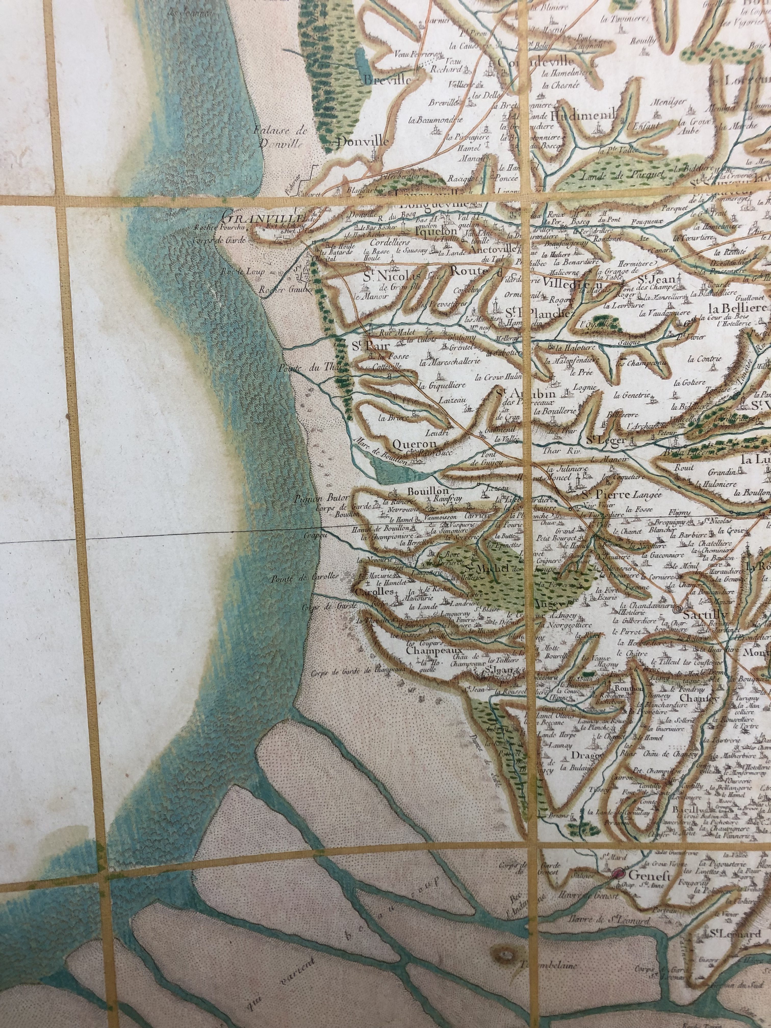
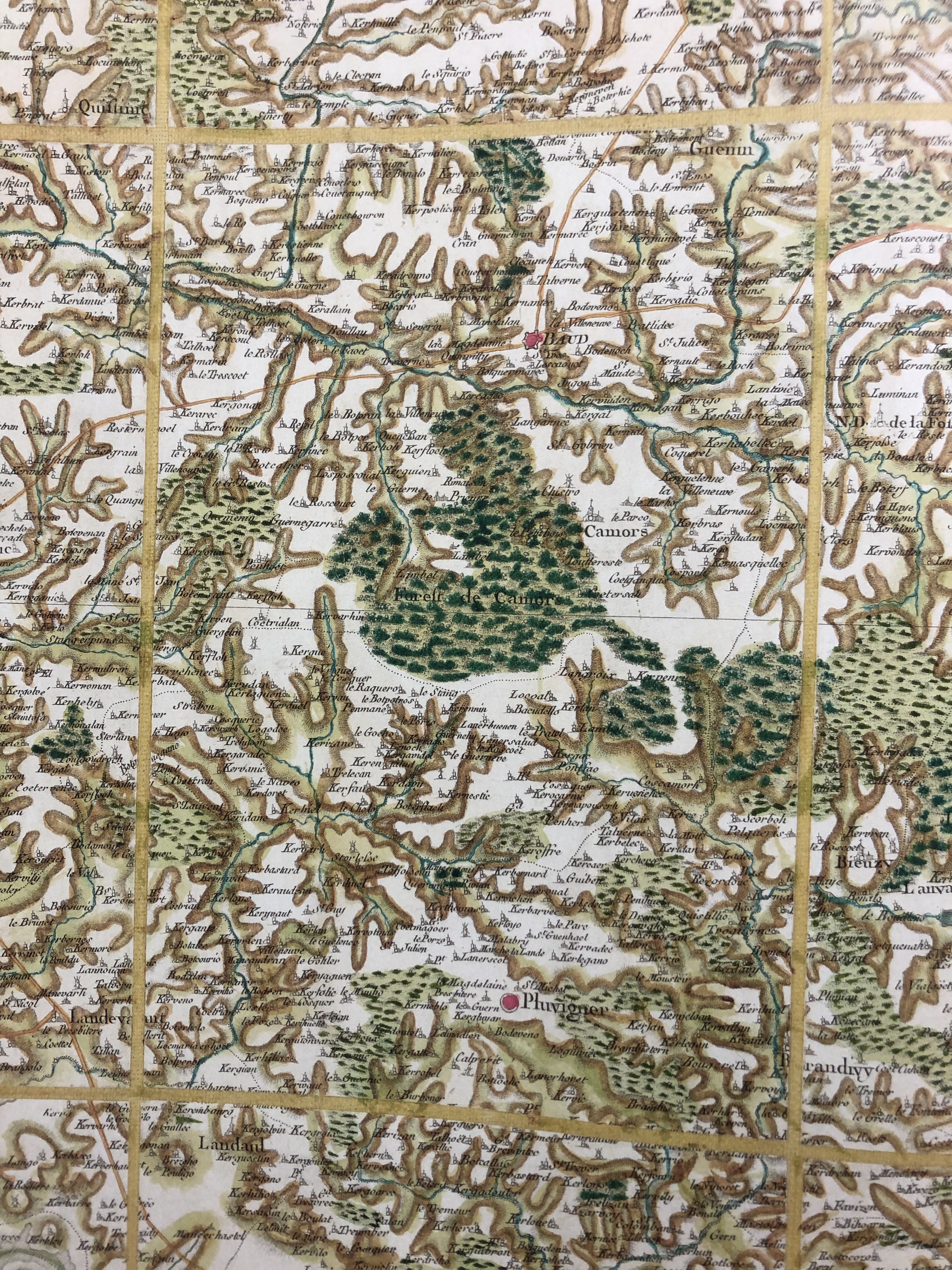
Over about 30 years, this mapping project would give us the maps bound in the atlas just added to the AGSL’s collections. Cassini III and Cassini IV (after 1784) oversaw the process with care: they had ten different teams of surveyors spread out over the country at any given time, asking them to make extensive notes on both the geodetic measurements they were making and topographic and toponymic information like physical landmarks, church locations, and place names to include in the maps. The result was 182 sheets which measured 65×95 centimeters each, covering the entirety of France.
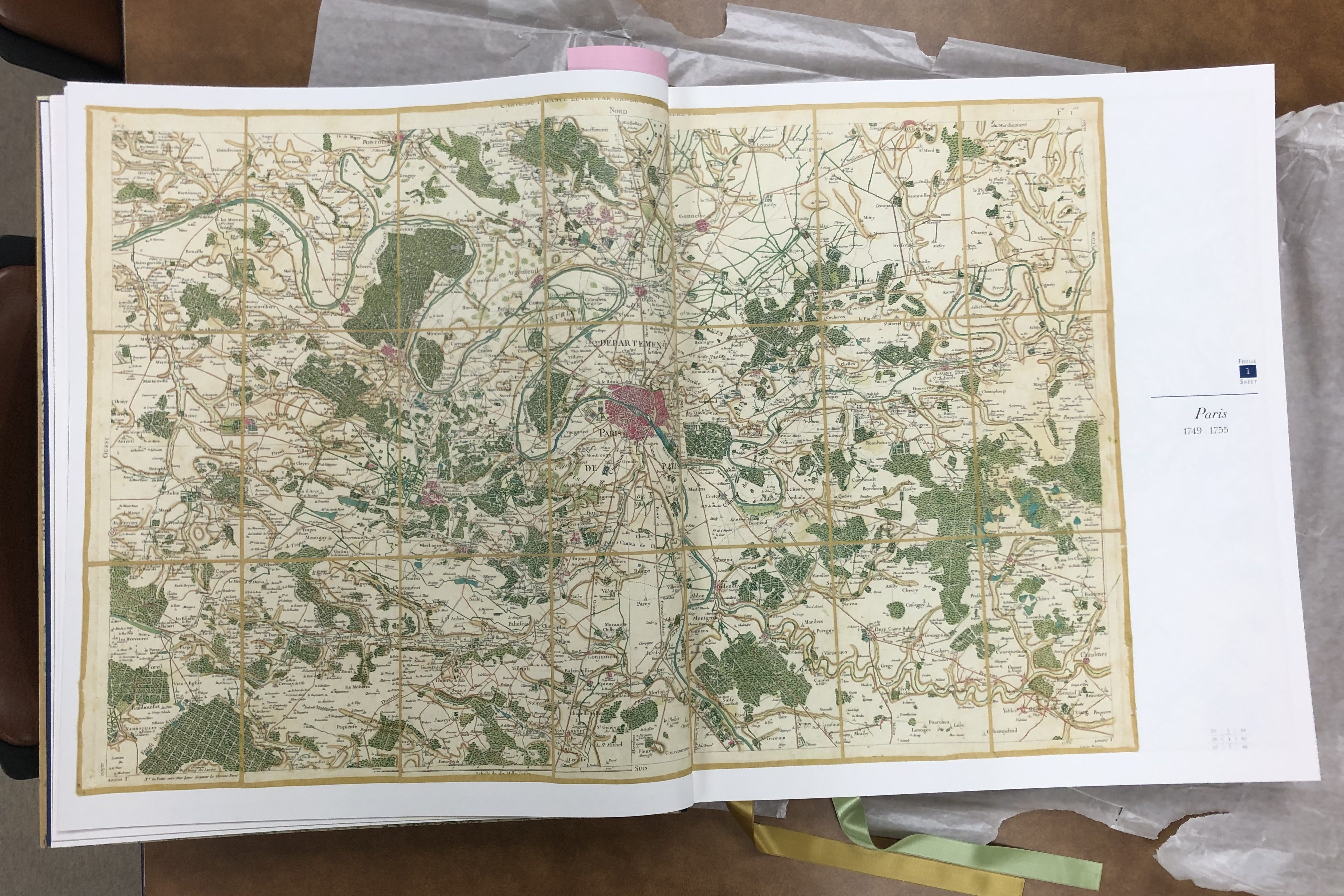
While the maps would have been an impressive point in the history of mapping because of the size of the project and the innovation in measurements alone, they also left an important legacy in the political and social histories of mapping. The Cassinis’ massive mapping endeavor was initially made possible because France’s kings wanted accurate, comprehensive maps to help them govern, quantify, and tax the nation they ruled. To make that possible, the Cassinis not only imposed the lines of measurement on France, they also developed and standardized what historian Jerry Brotton calls a “new language of cartography” through their maps, where standardized symbols, lettering, and notations made the culturally and linguistically diverse county seem like a unified nation—and one happily overseen by a monarch (Brotton, 324).

But before the maps were completed, the French Revolution altered the course of France’s nationhood, and of the Cassinis’ project. In 1793, the National Assembly ‘nationalized’ the map, forbidding the sheets that had already been published from being sold and confiscating all the Cassinis’ engraved plates to prevent more copies being made. From this point on, the maps were seen not just as navigational tools for the public, but as a way to unify the diverse peoples living within the national lines of France so that they could more effectively be governed. It was Napoleon’s Department of War who finished printing the full series of maps in 1815, helping the infamous emperor re-shape France’s identity for himself.
If you’d like to see our stunning copy of the Cassini’s historic atlas for yourself, stop by the AGSL sometime this summer! To read more about the Cassini map, check out chapter 9 of Jerry Brotton’s A History of the World in Twelve Maps or the website of the publisher of our new atlas. Or you can schedule an appointment to view two original sheets of the Cassinis’ map using our Rare Materials Viewing Form!
